

Mediterranean Conservation Foundation
TREN
Support us

Field programme · Climate Change

Blue carbon

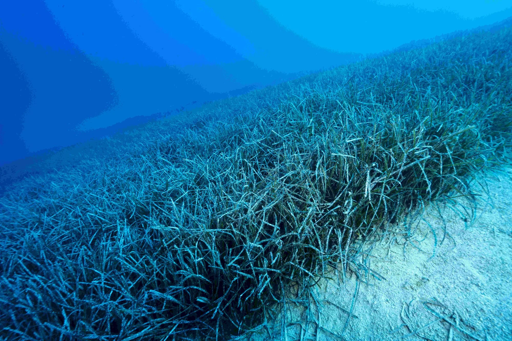
The carbon stored by seagrasses is defined as blue carbon.

Photo: Akdeniz Koruma Vakfı Arşivi

Start
2016
Support
European Union Horizon 2020 support
Where
Kaş, Göcek, Gökova
With whom
Ege University and Bangor University (UK); UNEP World Conservation Monitoring Centre (WCMC)

At a glance

  1. Among all plant habitats in the world, seagrass meadows are among those with the highest carbon storage capacity.

  2. The carbon stored by seagrasses is defined as blue carbon.

  3. 90% of seagrass habitats in the Mediterranean have been destroyed.

  4. It will be usable in the fight against the climate crisis in voluntary carbon credit markets in the world and in Türkiye.

%90
Share of seagrass habitats in the Mediterranean that has been destroyed
9
Stations established in Kaş, Göcek and Gökova in 2021
672
Total samples prepared for analysis

About

Among all plant habitats in the world, seagrass meadows are among those with the highest carbon storage capacity. The carbon stored by seagrasses is defined as blue carbon. 90% of seagrass habitats in the Mediterranean have been destroyed. For seagrass meadows, which are of such great importance for underwater life, the decline is further accelerated by boats anchoring and dragging, invasive algae species (Caulerpa taxifolia, etc.), over-feeding at fish farms, degradation of the coasts, homeowners in holiday homes and housing estates having these plant communities cleared because they are bothered by them while swimming, and the water surface being covered by ghost nets and other waste so that light cannot reach the seagrasses.

Blue carbon

What we do

Posidonia oceanica monitoring

Monitoring work on the distribution, coverage and health of Posidonia oceanica (PO), one of the most important carbon stores and endemic to the Mediterranean, was started by the Mediterranean Conservation Society in 2016 with European Union Horizon 2020 support, and is being continued with support from other project grants.

Mapping with satellite imagery

Another work that complements and builds on this is the mapping of Posidonia oceanica meadows with satellite imagery under the Threatened Geographies Programme, which began in 2019. The work, which began in 2020 with literature review and compilation, will take shape with the UNEP World Conservation Monitoring Centre (WCMC) providing the basic data for the map through high-resolution ESA satellite imagery, and the Mediterranean Conservation Foundation verifying the imagery on site (groundtruthing).

Core samples and carbon analysis

Within the scope of the Posidonia oceanica monitoring work, from 9 stations established in Kaş, Göcek and Gökova in 2021, 24 core samples with 3 replicates were taken from the seabed, comprising 28 sub-samples representing each layer defined down to 1 m depth, in the form of 25 ml mud samples, and prepared for analysis (672 in total). After the collection, completed in 2021, the samples will be dried and ground, and analyses will be carried out, in collaboration with Ege University and Bangor University (UK), to determine the amount of carbon and the carbon capture rates and amounts.

01Posidonia oceanica monitoring

Monitoring work on the distribution, coverage and health of Posidonia oceanica (PO), one of the most important carbon stores and endemic to the Mediterranean, was started by the Mediterranean Conservation Society in 2016 with European Union Horizon 2020 support, and is being continued with support from other project grants.

02Mapping with satellite imagery

Another work that complements and builds on this is the mapping of Posidonia oceanica meadows with satellite imagery under the Threatened Geographies Programme, which began in 2019. The work, which began in 2020 with literature review and compilation, will take shape with the UNEP World Conservation Monitoring Centre (WCMC) providing the basic data for the map through high-resolution ESA satellite imagery, and the Mediterranean Conservation Foundation verifying the imagery on site (groundtruthing).

03Core samples and carbon analysis

Within the scope of the Posidonia oceanica monitoring work, from 9 stations established in Kaş, Göcek and Gökova in 2021, 24 core samples with 3 replicates were taken from the seabed, comprising 28 sub-samples representing each layer defined down to 1 m depth, in the form of 25 ml mud samples, and prepared for analysis (672 in total). After the collection, completed in 2021, the samples will be dried and ground, and analyses will be carried out, in collaboration with Ege University and Bangor University (UK), to determine the amount of carbon and the carbon capture rates and amounts.

Next steps

We need your support to keep this work going.